The Analysis: Translating Vertical Shear into Commercial Reality
Welcome to the inaugural briefing from Basis Climate Chicago. My professional journey has been defined by the pursuit of precision, spanning over a decade in applied mathematics, insurance, and earth sciences. This newsletter is the intersection of those worlds.
Most local weather updates prioritize 'chances of rain'; however, our methodology is anchored in the rigorous quantitative frameworks of Earth Sciences and Applied Mathematics. By bridging a B.S. in Earth Sciences with an M.S. in Applied Mathematics, we move beyond simple observation to perform advanced mathematical modeling of atmospheric volatility and localized risk across the Chicago area. This dual-disciplinary approach allows us to translate complex physical phenomena into precise, actionable commercial intelligence.
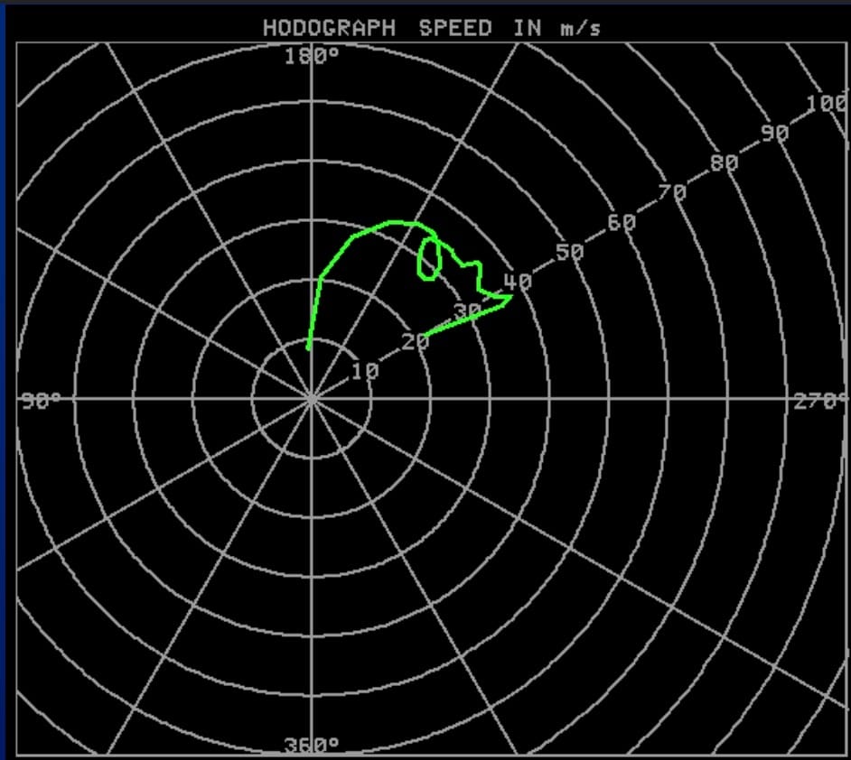
The image above—a QLCS (Quasi-Linear Convective System) Hodograph—represents the heartbeat of Chicago’s convective season.
Mathematical Precision: By analyzing the discrete curvature in the low-level wind shear (0-3 km SRH), we can differentiate between a standard thunderstorm and a high-velocity wind event that threatens infrastructure.
Actuarial Translation: For our partners in insurance and the nursery industry, this curvature is a leading indicator of "Basis Risk"—the gap between a general forecast and the actual physical loss potential of an asset.
Earth Sciences Application: Because of my background in the earth sciences and my experience with onsite supervision in the Midwest, I understand that these wind profiles translate directly into operational downtime and safety hazards for Chicago-based crews.
Basis Climate Chicago exists to turn these complex meteorological vectors into the technical intelligence you need to manage risk in a volatile climate.